Manning Aerial Photography & Drone Image Gallery

At Airviewonline, we don't compromise on quality for cost, which might come as a surprise seeing as our photographs are extremely affordable. If you are looking for aerial shots of places in the Manning area then search no further. We highly recommend choosing us as your reliable source for stock photos in this beautiful, sought-after area.

We pride ourselves on our cost-effective, high-quality aerial images and we deliver only the best to our incredibly important clients, producing amazing results. 


Manning Aerial View Images For Personal & Commercial Use

While we are more than happy for anyone looking for a Manning aerial view to download our images, we find that our stock images are particularly effective for: 

 
  • Residential and Commercial Real Estate Agents and Businesses: Aerial photography is the latest trend in real estate and companies are using our images to show potential clients the highlights of the areas that they could buy into.
  • Property developers: As a property developer, it's important to know the lay of the land and our aerial photos help these companies to plan their building and also judge whether these are the best areas for their needs.
  • Architects: Architects need to be able to see a bird's eye view of the area to help them in the planning stages of their projects, as well as ensuring that their buildings fit in with the neighbourhood around them.
  • Local councils: Local councils are in charge of building laws, planning permission and a whole heap of other responsibilities. Our aerial shots of Manning help to give them an overview of the area that they are interested in.
  • Advertising and marketing agencies: Manning is a beautiful city and advertising and marketing companies use our pictures to promote companies, products and services found here.
  • Media and tourism: Our media and tourism industries need to sell Manning as a place to work and visit and being able to see how stunning the city is from the air helps them to promote it more effectively.

Hassle-Free Aerial Photography of Manning  


Most people are under the impression that they have to go out and hire entire marketing teams to get the aerial photos of Manning that they need for their businesses. However, our stock drone photo library means that you can simply click and download the photo or photos of the area you are interested in. This eliminates the need to hire an outside company and cuts down on not just the costs, but also the time involved in getting your hands on the photos you need.


We are specialists in aerial photography in Manning and all over Australia. If you'd like to know more about how you can download your perfect aerial photos, then simply get in touch and we'll be more than happy to help out.

Manning Drone Photography

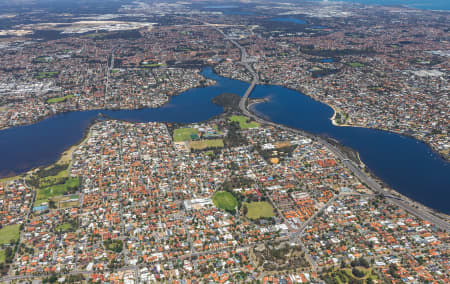
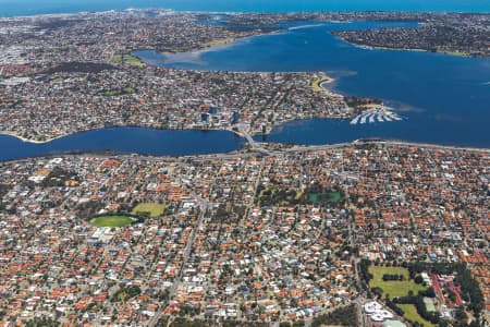
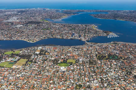
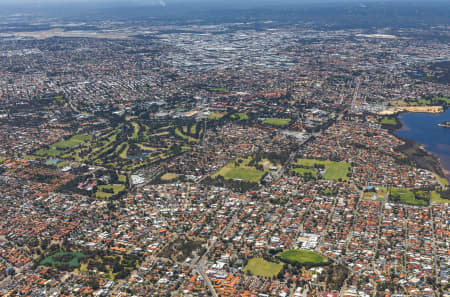
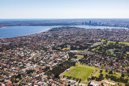
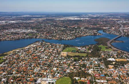
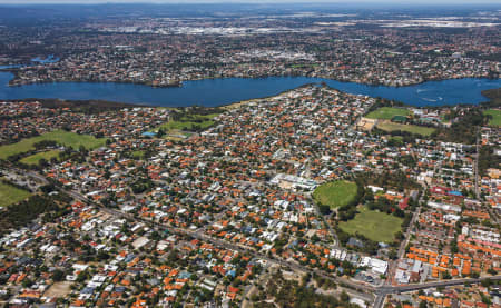
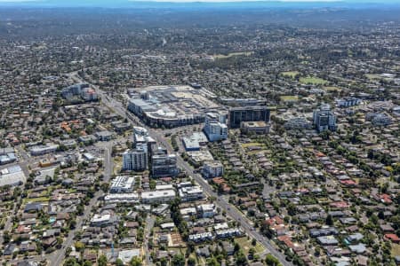
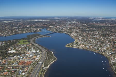
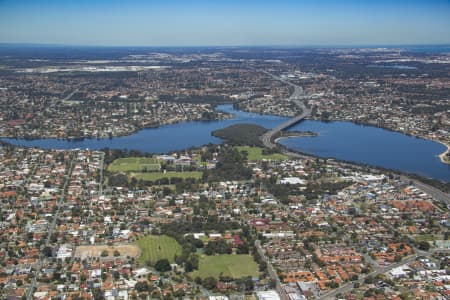
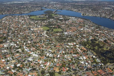
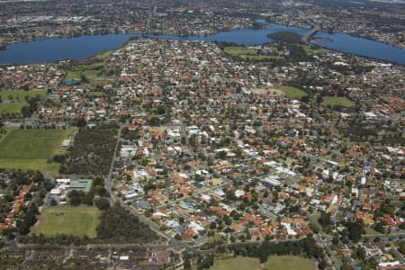
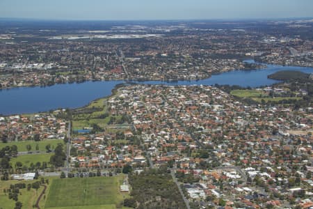
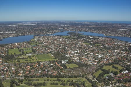
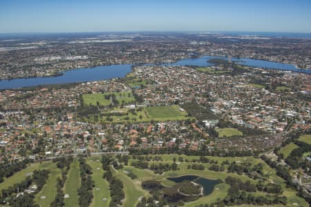
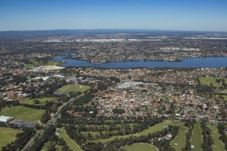
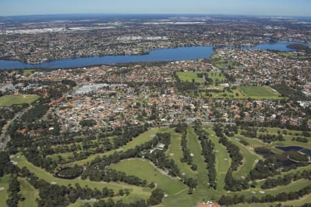
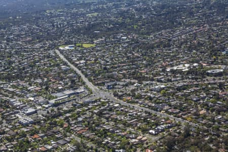
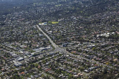
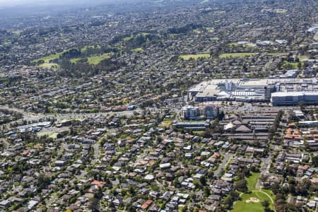
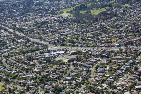
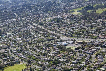
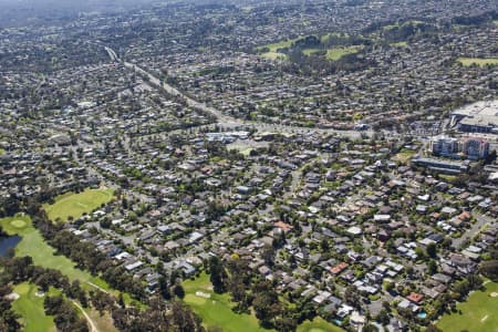
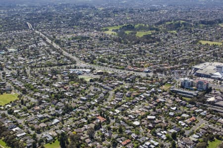
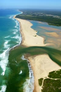
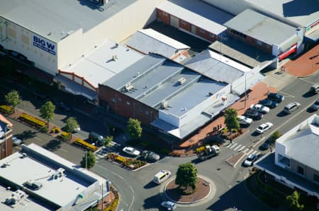
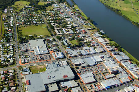
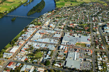
We have done photoshoots up in helicopters and using drones all over the Manning area. Some locations of the aerial photos we have taken in Manning are nearby landmarks such as Challenger Avenue Reserve, Como Secondary College, George Burnett Park, Manning Pre-School, St Pius X School, Canavan Reserve, Manning Primary School, Curtin Primary School, Mcdougall Park Community Kindergarten, Bradshaw Conochie Reserve, Koonawarra Primary School, Manning & James Miller Oval. << Read Less

Listing prices houses:

.....

Lorem ipsum dolor sit amet, consectetur adipiscing elit, sed do eiusmod tempor incididunt ut labore et dolore magna aliqua dolore magna aliqua sed aliqua dolore magna aliqua dolore magnaaliqua dolo Lorem ipsum dolor sit amet, consectetur adipiscing elit, sed do eiusmod tempor incididunt ut labore et dolore magna aliqua dolore magna aliqua sed aliqua dolore magna aliqua dolore magnaaliqua .

Listing prices units:

.....

Lorem ipsum dolor sit amet, consectetur adipiscing elit, sed do eiusmod tempor incididunt ut labore et dolore magna aliqua dolore magna aliqua sed aliqua dolore magna aliqua dolore magnaaliqua dolo.

Airview Online Subscription

Subscribe to access suburb trends information.

Sample Data Subscribe Today! Login

Aerial Image of MANNING
MANNING
117269
Aerial Image of MANNING
MANNING
117268
Aerial Image of MANNING
MANNING
117266
Aerial Image of MANNING
MANNING
116403
Aerial Image of MANNING
MANNING
112122
Aerial Image of MANNING
MANNING
112117
Aerial Image of MANNINGHAM
MANNINGHAM
101731
Aerial Image of MANNING, WESTERN AUSTRALIA
MANNING, WESTERN A...
90313
Aerial Image of MANNING, WESTERN AUSTRALIA
MANNING, WESTERN A...
90312
Aerial Image of MANNING, WESTERN AUSTRALIA
MANNING, WESTERN A...
90311
Aerial Image of MANNING, WESTERN AUSTRALIA
MANNING, WESTERN A...
90310
Aerial Image of MANNING, WESTERN AUSTRALIA
MANNING, WESTERN A...
90309
Aerial Image of MANNING, WESTERN AUSTRALIA
MANNING, WESTERN A...
90308
Aerial Image of MANNING, WESTERN AUSTRALIA
MANNING, WESTERN A...
90307
Aerial Image of MANNING, WESTERN AUSTRALIA
MANNING, WESTERN A...
90306
Aerial Image of MANNING, WESTERN AUSTRALIA
MANNING, WESTERN A...
90305
Aerial Image of LOWER TEMPLESTOWE AND MANNINGHAM ROAD
LOWER TEMPLESTOWE ...
74571
Aerial Image of LOWER TEMPLESTOWE AND MANNINGHAM ROAD
LOWER TEMPLESTOWE ...
74569
Aerial Image of DONCASTER AND TEMPLESTOWE
DONCASTER AND TEMP...
74559
Aerial Image of DONCASTER AND TEMPLESTOWE
DONCASTER AND TEMP...
74558
Aerial Image of DONCASTER AND TEMPLESTOWE
DONCASTER AND TEMP...
74557
Aerial Image of DONCASTER AND TEMPLESTOWE
DONCASTER AND TEMP...
74556
Aerial Image of DONCASTER AND TEMPLESTOWE
DONCASTER AND TEMP...
74555
Aerial Image of FARQUHAR INLET.
FARQUHAR INLET
44884
Aerial Image of CLOSEUP OF TAREE CITY CENTRE.
CLOSEUP OF TAREE C...
40154
Aerial Image of TAREE TOWNSHIP.
TAREE TOWNSHIP
40153
Aerial Image of TAREE TOWNSHIP AND MANNING RIVER.
TAREE TOWNSHIP AND...
40152
Aerial Image of TAREE TOWNSHIP AND MANNING RIVER
TAREE TOWNSHIP AND...
39779

Can't find what you are looking for?

Speak with our Aerial Photography Specialists today to find exactly what you need.

Get in touch

Please send us a message by filling out the form below and we will get back with you shortly.

This field is required.

This field is required.

This field is required.

This field is required.

This field is required.

×
GET IN TOUCH